See what your students are learning, live.
Students play through 11 maps of missions, lessons, and mini-games. You get a dashboard that shows who has mastered which geography standards, for your state, as they play.
Sign in with Google. No payment details. The World map stays free after the trial.
Up and running in three steps
No rosters to upload, no student emails needed, nothing to install.
Sign in with Google, name your class, and pick your state. Your students will see your state's standards.
Students go to geojag.com and type your 6-letter class code. Schools that set it up can also use school Google sign-in.
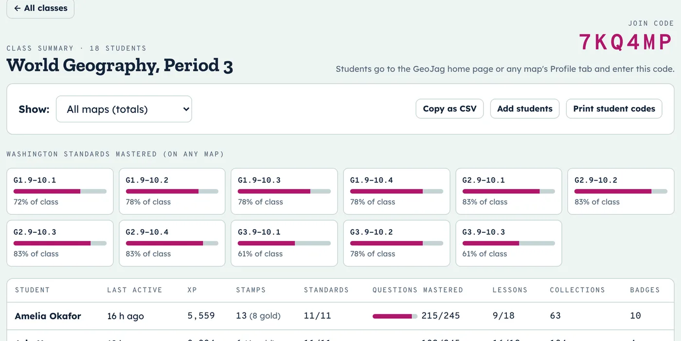
Your dashboard updates as students play: XP, passport stamps, lessons, and standards mastered.
Know who's mastered what, at a glance
Each standard shows the share of your class that has mastered it. A student masters a standard by earning a passport stamp in every mission that practices it, so mastery means repeated success, not one lucky answer.
- Filter to one map or see totals across all of them
- Copy the whole class as a spreadsheet (CSV)
- Spot who hasn't played lately
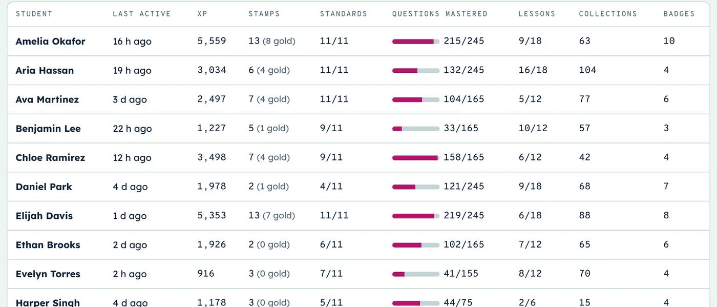
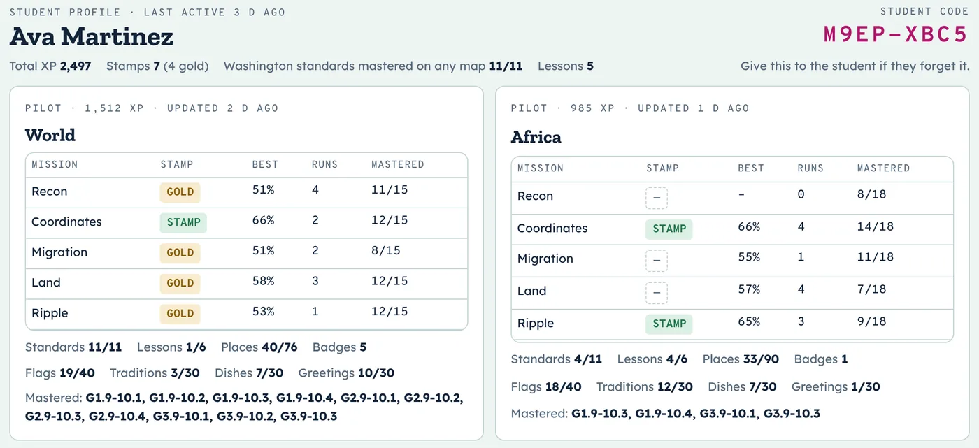
Every student's passport, in detail
Click any student to see their stamps, best scores, attempts, and questions mastered for each mission on every map they've played, plus lessons, collections, and the standards they've mastered.
- Great for conferences and IEP check-ins
- Their private student code is right there if they forget it
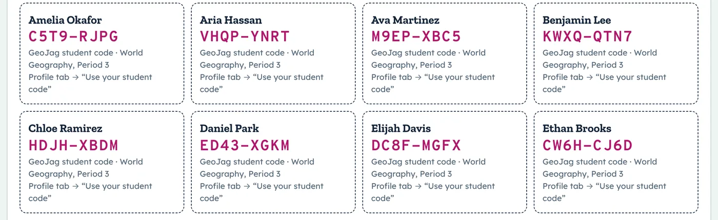
Print codes, hand them out, done
Add students yourself or let them join with the class code. Either way, every student gets a private code to sign back in on any device. Print them as cards in one click.
Aligned to your state
GeoJag was built on Washington's high school geography standards and aligned to the national C3 Framework and every state. Pick yours to see what your students will practice.
What students do
Every map has the same five missions, short lessons to learn first, and mini-games that make each country memorable.
Plus flag, culture, food, and language mini-games, ranks from Flight Cadet to GeoJag Ace, and a passport full of stamps.
A sample week
One way to use GeoJag alongside a regional unit. Missions are short, so each day leaves room for your own teaching.
Questions teachers ask
Do students need email addresses or accounts?
No. Students join with your class code and get a private student code. If your school sets it up, they can sign in with their school Google account instead.
Does it work on Chromebooks?
Yes. GeoJag runs in the browser on Chromebooks, laptops, tablets, and phones. Nothing to install.
Which standards are covered?
Washington's grades 9–10 geography standards, the C3 Framework, and a best-fit alignment for every other state. See your state's alignment.
What does it cost?
The World map is free. Premium unlocks the ten regional maps for $59 a year per teacher, or $299 a year for up to five teachers at a school. Purchase orders are welcome. See plans.
What about student privacy?
GeoJag stores only a student's name, their school email if they use Google sign-in, and their game progress. No ads, and data is never sold. We'll sign your district's data privacy agreement. Read the privacy notice.
What happens after the free trial?
Your classes keep the free World map and all their progress. Upgrade any time and the regional maps unlock again right away.
Try every map free for 10 days
Set up your first class in about a minute.